HOME > O'AHU ISLETS

O'ahu islet map

For more information click on an islet name on the map or select from the list below. Islets that are washed over by waves and lack any flora or fauna are not detailed here.

> Kaohikaipu (Black Rock)

> Kapapa (Mokukapapa)

> Kekepa (Turtle Rock)

> Kihewamoku

> Kuka'imanini

> Kukuiho'olua

> Manana (Rabbit Island)

> Mokauea

> Mokolea

> Mokoli'i (Chinaman's Hat)

> Moku manu

> Moku o Lo'e (Coconut Island)

> Mokualai

> Moku'au'ia (Goat Island)

> Mokulua

> Popo'ia (Flat Island)

> Pulemoku

Kuka'imanini
Kuka'imanini
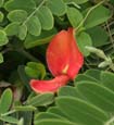
Morning glory flower
Photo: H. Eijzenga

A small islet less than 1 acre in size and located just offshore Waiale'e Beach Park on O'ahu's north shore.
The islet is State owned and all native flora and fauna on the islet is protected under State and/or federal law.

Literature Citations:

Hawaii, S.o. 1969. Geographic names approved, second quarter 1969, p. 8. In: Development, D.o.P.E. (ed.), State of Hawaii8.

KaohikaipuKapapaKekepaKihewamokuKuka'imaniniKukuiho'oluaMananaMokaueaMokoleaMokoli'iMoku manuMoku o Lo'eMokualaiMoku'au'iaMokuluaPopo'iaPulemoku