 |
|
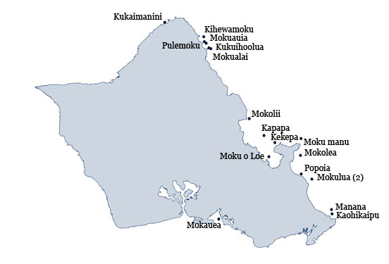
Moku o Lo'e (Coconut Island)
|
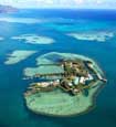
Aerial view
Photo: HIMB website
|
22 acre islet located offshore Kalaupapa peninsula in Kaneohe Bay. The islet was origninally 11 acres, but the previous private owners dredged the surrounding coral reefs to expan the island to its current size.
The islet is owned by the University of Hawai'i and Paul-Pagen Laboratory. It is home to the Hawai'i Institue of Marine Biology and their permission is necessary to access the islet.
|
|
| Literature Citations: | Hawaii, S.o. 1969. Geographic names approved, second quarter 1969, p. 8. In: Development, D.o.P.E. (ed.), State of Hawaii8. MacCaughey, V. 1918. The strand flora of the Hawaiian Archipelago-I. geographical relations, origin, and composition. Bulletin of the Torrey Botanical Club 45(7): 18. Tomich, P.Q. 1986. Mammals in Hawai'i. 2. Bishop Musuem Press, Honolulu, HI. 375 p. | Additional information |
|
| |

|