|
Invasive Species Collected:
Acanthophora spicifera (Vahl) Børgesen
Cladophora vagabunda (L.) Hoek
Colpomenia sinuosa (Mert. ex Roth) Derbès & Solier
Hypnea spinella (C.Agardh) Kütz.
Ulva fasciata Delile
All Species Collected:
Acanthophora spicifera
Aglaothamnion boergesenii
Aglaothamnion cordatum
Amphiroa valonioides
Antithamnionella breviramosa
Bachelotia antillarum
Bangia atropurpurea
Boodlea composita
Branchioglossum prostratum
Centroceras clavulatum
Ceramium flaccidum
Ceramium vagans
Champia parvula
Chondria dangeardii
Chondria simpliciuscula
Cladophora vagabunda
Codium edule
Colpomenia sinuosa
Dasya pilosa
Enteromorpha compressa
Enteromorpha prolifera
Falkenbergia hillebrandii
Gelidiopsis scoparia
Griffithsia heteromorpha
Griffithsia schousboei
Herposiphonia crassa
Herposiphonia dubia
Herposiphonia pacifica
Hincksia indica
Hypnea pannosa
Hypnea spinella
Jania adhaerens
Lobophora variegata
Martensia fragilis
Melanamansia glomerata
Microdictyon setchellianum
Polysiphonia beaudettii
Polysiphonia upolensis
Pterocladiella caerulescens
Pterocladiella capillacea
Sargassum echinocarpum
Symphyocladia marchantioides
Taenioma perpusillum
Tiffaniella saccorhiza
Ululania stellata
Ulva fasciata
Ulva rigida
Valonia aegagropila
|
Description:
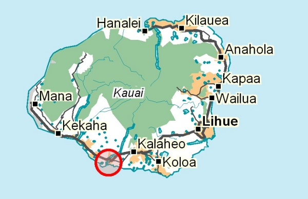
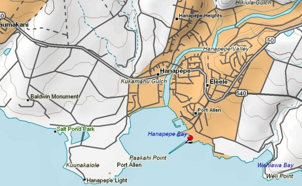
Built in 1962, one of the two deep draft harbors on the island. Provides slips and moorings for approximately 40 vessels and contains a coast guard station.
Freshwater
Inputs:
Turbidity:
Nutrients:
Collection
Dates: 17.Jan.2001; 26.Apr.2001
Samples:
Samples were collected along the inner side of the break wall, along the tidal shelf on the south side of the coast guard shack, and outside the break wall. Also along the berth and piers of the yachts.
|