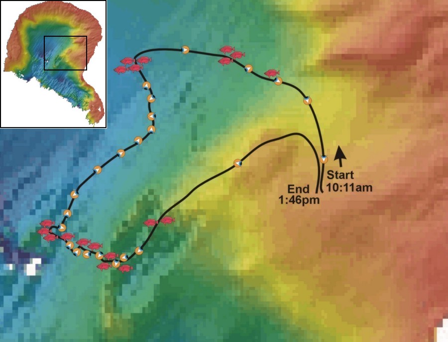
This map shows the approximate dive path (black line), overlaid against the
bathymetry data for Fagatele Bay. This dive path was reconstructed by hand, based
on videotape data synchronized with depth profile data as downloaded from the rebreather,
and represents a very close approximation to the actual dive path. Along the dive path,
you'll see two types of icons. These are links to still images captured from the video
taken during this dive. The "eyeball" icons -  - represent habitat
views, and point in the direction of the view. The "fish" icons - - represent habitat
views, and point in the direction of the view. The "fish" icons -  -
represent images of interesting fishes. These images are relatively crude, but serve as
documentation of habitat type and fish records. -
represent images of interesting fishes. These images are relatively crude, but serve as
documentation of habitat type and fish records.
|